 Here’s why Primary Teacher Sarah M. Thurlbeck believes atlases are essential in her classroom:
The “mental map”
In this digital age of global connectivity it is more important than ever that pupils develop some sort of global “mental map”. They need to be able to visualise where they are placed in the world. Children need to know about the geography of their own country and then be able to learn about other countries and continents.
Atlases and literacy
Atlases are wonderful non-fiction books. Many children are excited by their pages of colourful maps, photographs and diagrams. From a literacy point of view they can learn how to navigate other non-fiction books by practising using contents, indexes and glossaries and also develop their skills in scanning for information. Pupils love being able to dip in and out of the pages and browse what interests them.
Atlases and social studies
Social studies topics can be enhanced by showing how much geography has played a part in discoveries, conflicts and developments. Maps in atlases not only show physical regions but also political boundaries and areas. In addition, maps and diagrams in atlases can give very visual information about population, languages, trade commodities, transport routes and many other areas of interest, for example flags and wildlife.
Atlases and current affairs
As pupils hear of current affairs from news and social media they can turn to atlases as valuable sources of information. Which countries make up the EU? An atlas page will quickly show this and may be accompanied by pictographs showing amounts of imports and exports between countries.
When tomorrow’s eco warriors want to understand a statement such as “An area the size of Wales is being cut down each year in the rainforest” they can look at a world map and see for themselves the size of Wales in comparison with rainforest areas. When investigating climate change pupils can look to see where melting polar caps are. They can predict where low lying areas of the world might be affected by flooding.
It might be argued that in today’s digital age children can find many maps and images on the internet. However, sets of atlases bring together these maps and images to be shared in classrooms. Atlases pool together all sorts of nuggets of information and children still need to be taught the skills to read and interpret maps and diagrams effectively. Across all areas of the curriculum atlases can be used as colourful, beautiful books to feed inquisitive minds and stimulate imaginations.
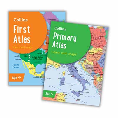
You can discover the full range of Collins School Atlases here.